If you’re looking for a full day, spectacular hike with 360 views in Sierra de Cazorla, Segura y Las Villas Natural Park, then Pico Gilillo is an excellent choice.
Easily accessed from the village of Cazorla, it’s a popular route, though most hikers don’t make it to the actual top, but just cross the mountain pass right next to the peak where they continue down on the other side.
If you’re just a little bit like me and aim for reaching the highest points wherever you go, the last little scramble is well worth it.
I’ve put together this guide so you comfortably can hike Pico Gilillo from Cazorla and reach the top in a day.
Disclosure: This post may contain affiliate links. That means that if you make a purchase through one of those links, I will get a small commission at no extra cost to you. As an Amazon Associate, I earn from qualifying purchases.
I’m Linn Haglund, the face behind Andalucia Hiking. I’m an avid hiker and after calling Andalucia home for over 10 years, I’ve covered my share of peaks, ravines, rivers, and valleys across all 8 provinces. I’m here to help you navigate this incredible region with thorough hiking guides, hiking tips, and gear recommendations.
Table of Contents
Practical information
- Province: Jaen
- Mountain range: Sierra de Cazorla
- Length: 20 km
- Time: 7-9 hours
- Altitude: 1847 masl
- Elevation: 1094 m
- Route: Circular
- Difficulty: Medium-Demanding
- Hiking with dogs: This trail goes through large pine forests. Thus, hiking with dogs is safe only during the autumn period until the end of December/beginning of January. This is when the pine processionary caterpillars come out which can be deadly for dogs. They usually can be seen until near summer. Further, there are hardly any natural water sources along the trail, so you need to bring enough water for your pet too. Read my top tips for hiking with dogs here.
READ: Best gifts for hikers
How to get to Pico Gilillo Cazorla
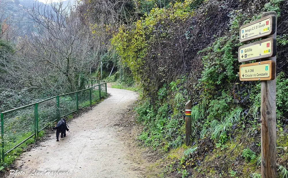
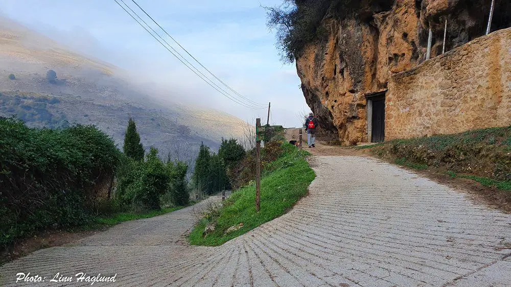
The trailhead to Pico Gilillo starts at the same point as Ruta Rio Cerezuelo in the village of Cazorla. Walking straight up from the tourist information towards the castle, you’ll see a small parking where the trail starts about a hundred meters up to your left.
The easiest way to get to Cazorla is by car. Yet, there are buses both from Jaen and Granada. From Jaen it takes about 2 hrs 30 min and from Granada it’s a journey of close to 4 hrs. As there are not very frequent buses from either city, you’ll have to spend at least the night before and after in Cazorla to do the hike.
The closest airports are in Granada, Malaga, and Almeria.
YOU MIGHT ALSO LIKE: How to hike Pico Chamizo, Malaga
When is the best time to hike Pico Gilillo
Though the natural park doesn’t usually see as hot temperatures as other parts of Andalucia, I wouldn’t recommend taking on this hike in the summer months of June, July, and August.
However, from mid-September to May it is nice to go hiking Pico Gilillo. Large parts of the hike go through pine forest but the higher parts are constantly exposed to the sun.
In the winter months between December and February it can get extremely cold on the top, so make sure you check the weather forecast so you’re well prepared.
READ: How to hike the highest peak in Almeria, El Chullo Sierra Nevada
What to bring
With Pico Gilillo towering above 1800 meters, it can get windy and cold on the top even though it’s warm where you start the trail. So no matter what time of year you choose to hike Pico Gilillo, make sure you bring layers of clothing and especially a windbreaker if needed for the top. Bring a daypack that’s good to wear and sits well even during scrambling.
Especially in spring and early autumn you should think about protection from the sun, but also consider colder temperatures in the shady parts of the trail.
This is a long hike so, among the must-have hiking gear, I do recommend that you bring a headlamp in case it gets dark before you get back down, especially in winter when the days are short. In December the sun goes down as early as 6 PM.
As it’s a long hike with a steep descent, trekking poles and knee braces can be of good support.
See more hiking gear and gadgets here.
Make sure you bring at least these things on your hike to Pico Gilillo:
- water
- hiking shoes or boots
- caps
- sunscreen
- lunch
- snack (fruit, nuts, energy bar)
- knee brace
- hiking poles
- headlamp
- camera
Where to stay when hiking Pico Gilillo
Cazorla is definitely the best place to stay when hiking Pico Gilillo, since the trail starts in the village. Here are a couple of good options.
Apartamentos Castillo Cazorla
This apartment hotel is perfectly situated just a minute’s walk from the trailhead. There’s a bakery just around the corner, and it’s perfect with a kitchen so that you can prepare a good lunch pack for your hike. You’ll need the energy. This place is also pet friendly.
Hotel Limas
Hotel Limas is another good option. This doesn’t have a kitchen and is situated further down in the village, so it’s a longer walk to the trailhead. It’s reasonably priced and has a restaurant and bar that serve breakfast.
Other epic hikes in Sierra de Cazorla, Segura y Las Villas Natural Park:
Hiking Pico Gilillo
Hiking Pico Gilillo is a full day adventure, and depending on your physical condition, you might spend longer than described in this post, so make sure you hit the trails early in the morning, especially in the winter months, you should leave at least 10 hours before sunset, if not more. Nonetheless, bring your headlight just in case.
The hike up to the top of Pico Gilillo
The start of the trail is at the same place as the more popular Rio Cerezuelo hike. You’ll see a sign to Gilillo to the left, right after you start. You can either follow that sign and walk the main trail up or walk the more scenic path up along the river. I recommend walking along the river, as it’s absolutely gorgeous.
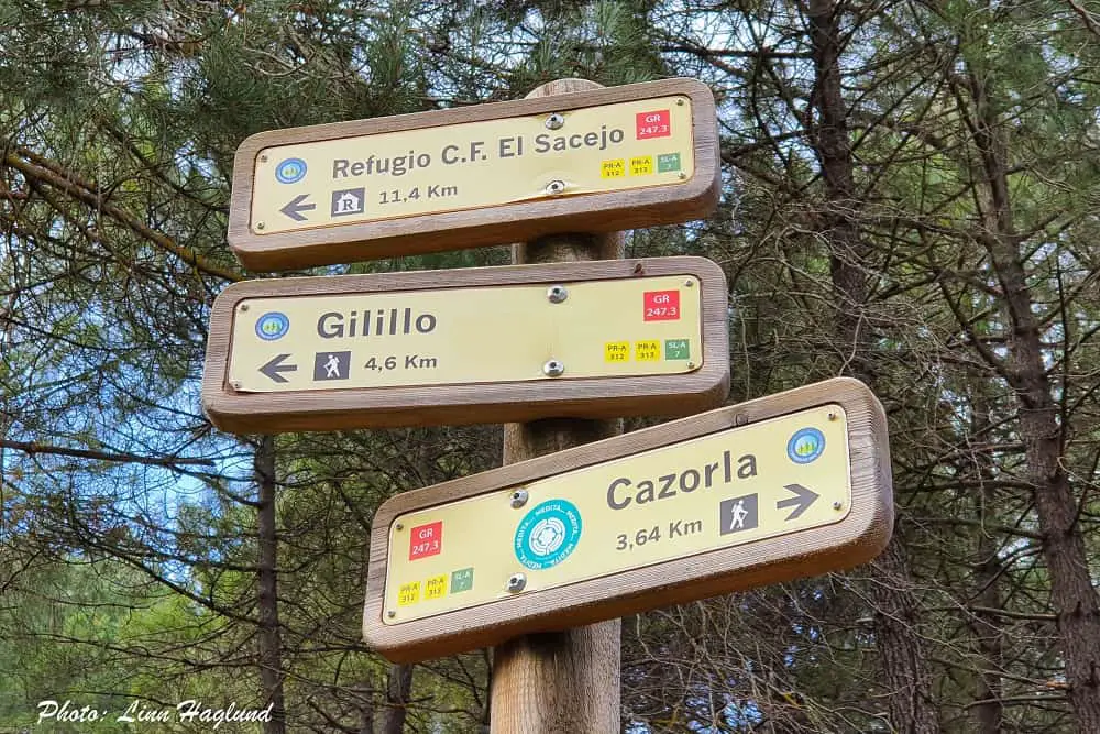
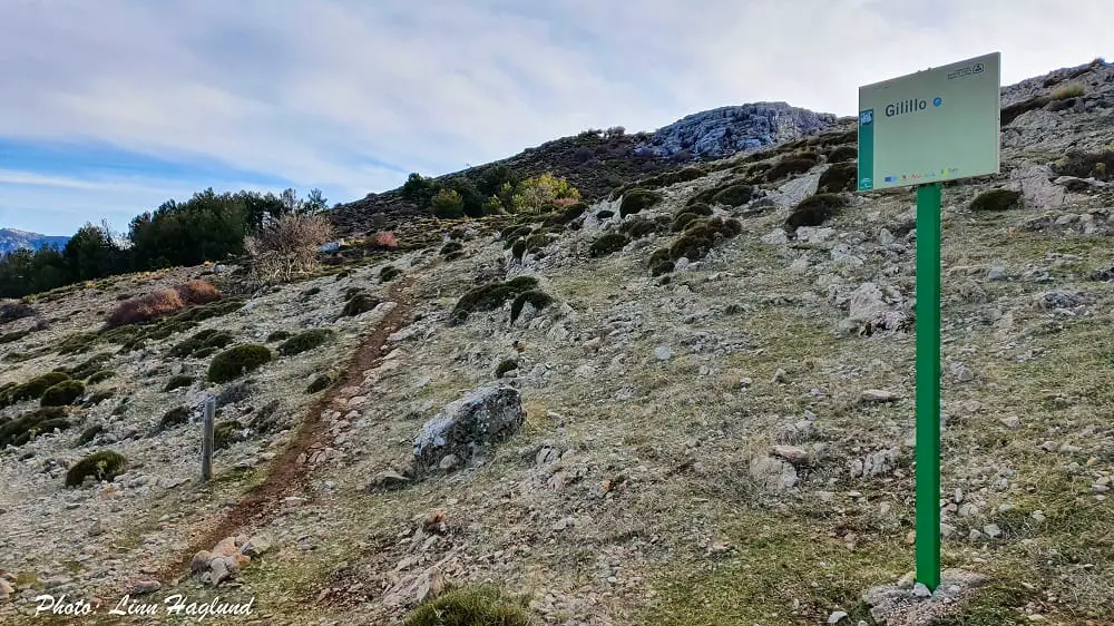
Once you get to the top of the river, at a junction where you can take either left or right (towards Cascada de la Malena), you take left, where the path will take you a little bit back past a couple of houses. Where the road divides in two, you take the right path that goes upwards. The left is where you would have come from if you followed the signs to Gilillo at the bottom (instead of following the river).
Now, it’s easy to follow the trail all the way to the top, as it’s well marked even though it’s crossing the road a few times. You’ll pass a number of drinking fountains, the water isn’t treated, but the locals (and myself) drink from them without any problems. It’s pure mountain water and tastes lovely!
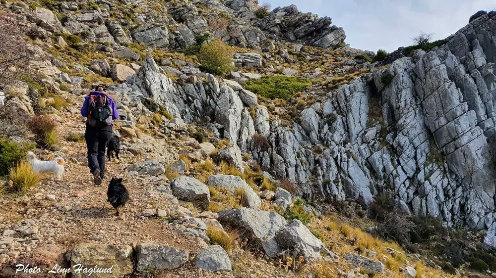
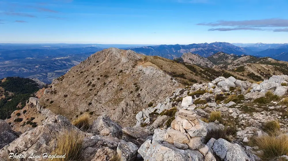
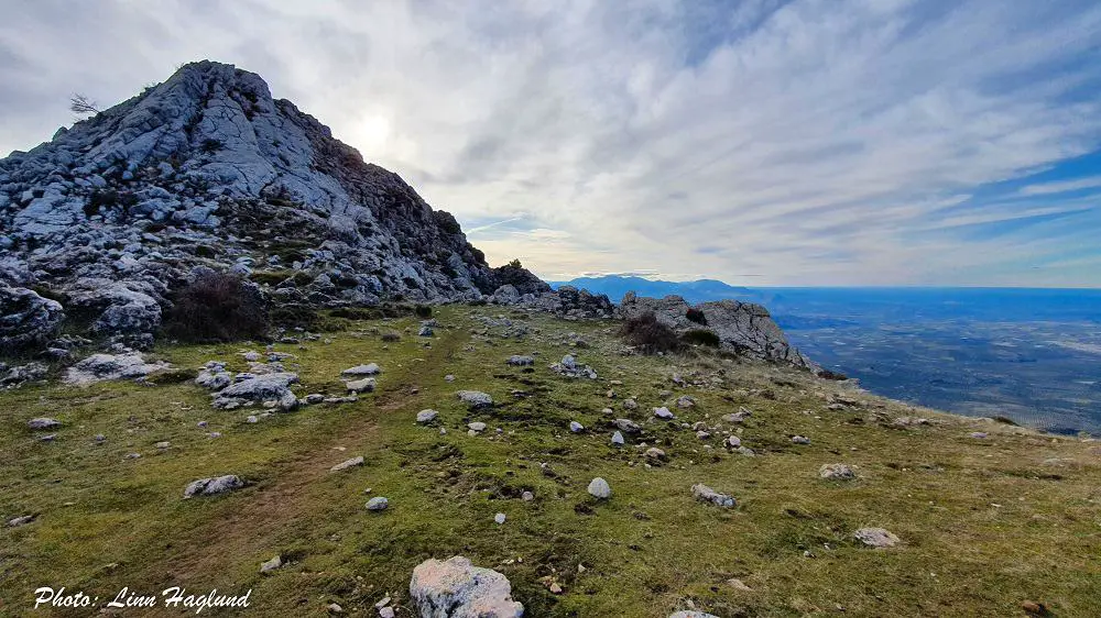
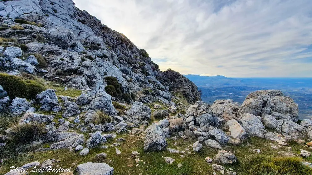
After a dense forestry trail, you get higher up, and the scenery starts to open up with less trees and greater views. The path follows the mountain wall for a while before climbing up to spectacular views on the other side too. The peak is now to your right.
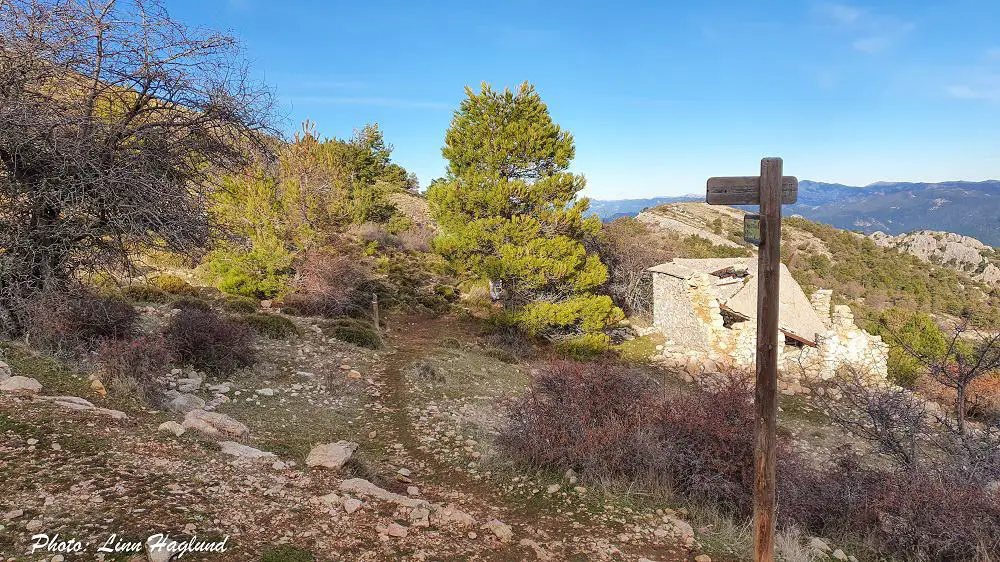
If you continue the path a few meters down, there is a junction by an old collapsed Refugio where you can go straight, left, or right. The left is where you walk back down after you’ve been to the peak.
To the right, there’s a sign saying Gilillo. Follow the path towards the peak and when you stand in front of the rocky mountain, follow it along the right side where you’ll easily be able to scramble up the last bit to the top. Be careful on this last section.
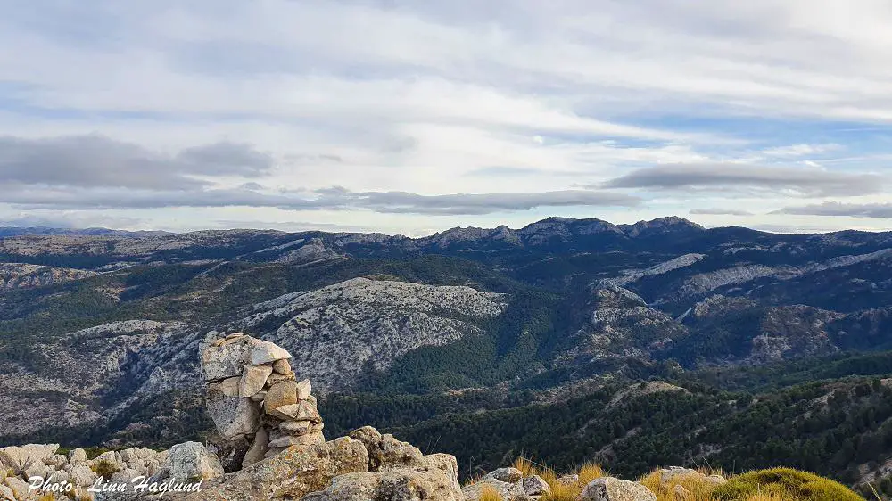
The top of El Gilillo
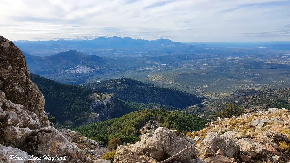
Once you get to the top of the peak, the 360 views will blow you away! You can see the trail where you came from too, which is pretty cool. There are mountains as far as you can see in all directions.
El Gilillo peak might be the highest peak in Sierra de Cazorla, but it isn’t the highest in the natural park, which includes three different mountain chains, Segura and Las Villas in addition to Sierra de Cazorla. Therefore, there are several 2000 meters peaks surrounding El Gilillo too.
The hike down from Pico Gilillo
After soaking in the astounding 360 views of the top of Pico Gilillo, climb back down where you came from and walk back down to the junction by the collapsed Refugio. You keep walking straight, past the Refugio (you came from the left, but you’re going back down a different trail).
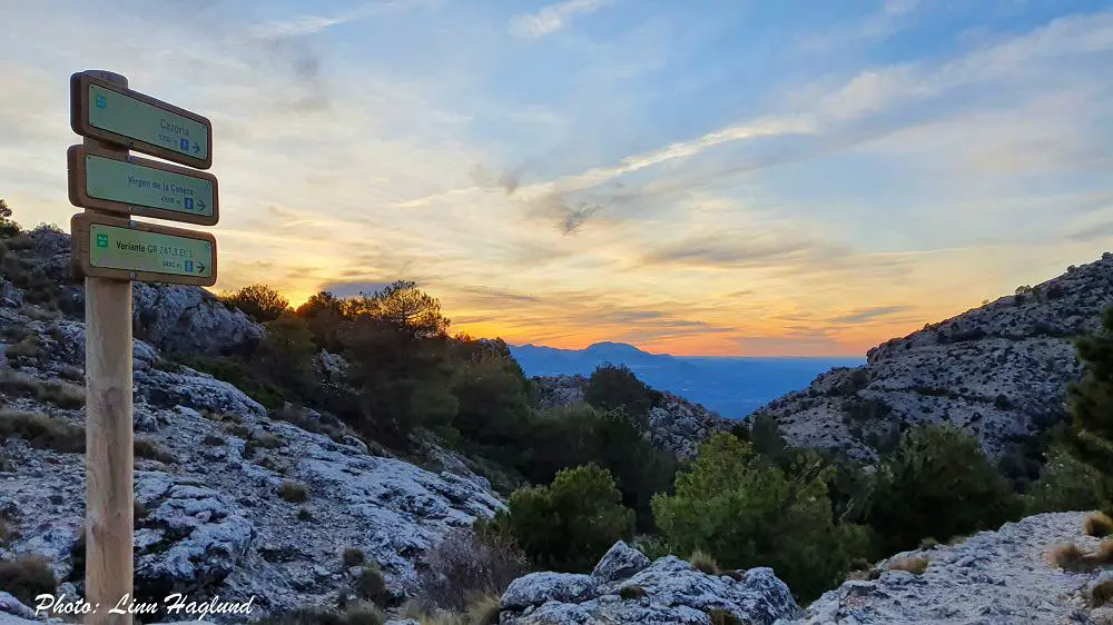
The path is partly open landscape partly forested and the trail is easy to follow. After walking down a large forest, you get to a junction on top of a ridge. You follow the signs to the left towards Cazorla the rest of the way.
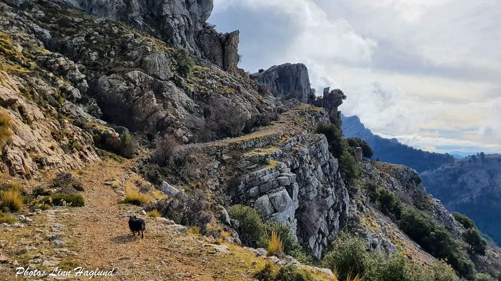
After a while, the path becomes very steep with vertical drops on the side as you climb down the mountain side. This is not for the faint hearted, so you might consider taking the alternative route as described below.
If the sun starts to go down, I also recommend you take the alternative route, as this can be really sketchy in the dark. I walked down here in pitch black with a headlamp and it wasn’t exactly a pleasant experience.
Once you get down to the main road, the difficult part is over. Cross the road, and continue down the dirt road until you get to the U-turn where you either came from the left (if you followed the river up at the start) or from the right (if you followed the first sign to Gilillo in the beginning). Continue down to the right here until you arrive at the same spot where you started the hike in the morning.
Alternative route down
If heights isn’t your thing or if you’re worried it might get dark before you reach down, there is an alternative route down which is a little longer, but a lot easier.
When you’re at the junction on top of the ridge where you turn left towards Cazorla, there are also signs towards Virgen de la Cabeza. The sign follows the same trail as the one to Cazorla for a while, but then the sign to Cazorla takes off down a narrow path, while you want to keep walking on the one you’re following. There are signs to follow to Virgen de la Cabeza the whole way.
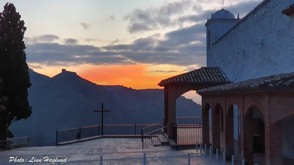
Once you get to the hermitage, Virgen de la Cabeza, you’ll see the views of Cazorla in front of you. Walk the trail down to the left from the hermitage and follow the trail through a forested area until you reach the village.
Walk the streets zig-zag down until you get to Plaza de Sta. Maria by the tourist office.
Reflections on Pico Gilillo
Pico Gilillo hike is definitely worthy of your Andalucia hiking bucket list. In the biggest protected natural area in Spain, views like that are nothing but mesmerizing. Yet, it shouldn’t be underrated and if you’re not used to walking in the mountain, it can feel pretty hard as it’s such a long trek and with an elevation of more than 1000 meters.
With that said, it’s not a challenging hike in itself and it’s well marked. It’s easy to walk the whole way up and if you don’t mind a bit of scrambling to reach the actual peak, you’ll absolutely love the whole hike.
As mentioned above, I had to do the last hour or more in the dark with a headlamp. I don’t recommend going down the steep part straight to Cazorla in the dark. Do the alternative route to Ermita Virgen de la Cabeza. It’s only a little bit longer, but there isn’t any chance of falling hundreds of meters down the ravine. Safety first!
Similar hikes in Andalucia:
- Pico de Mijas, Malaga
- La Concha hike, Malaga
- Mulhacen, Granada
- Pico Veleta, Granada
- Pico Torrecilla, Malaga
- Pico del Cielo, Malaga