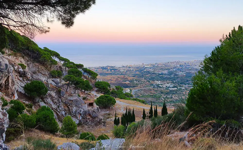
The impressive mountain range of Sierra de Mijas, overlooking the mesmerizing coastline from Mijas to Malaga on Costa del Sol has a myriad of hiking trails. Short and long. Easy and Hard.
Finding the right trail for you in Sierra de Mijas isn’t always easy. I’ve found myself searching for information for hours without any luck. That’s why I’ve put together a comprehensive guide to the top 5 hiking trails Sierra de Mijas has to offer.
This has been my beloved playground for more than 7 years and I’ve explored them all, so I’m really excited about sharing them with you so that you can enjoy these amazing mountains too.
Disclosure: This post may contain affiliate links. That means that if you make a purchase through one of those links, I will get a small commission at no extra cost to you. As an Amazon Associate, I earn from qualifying purchases.
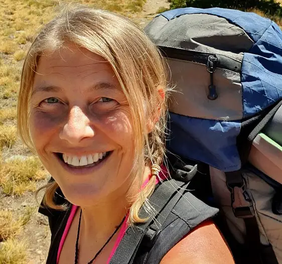
I’m Linn Haglund, the face behind Andalucia Hiking. I’m an avid hiker and after calling Andalucia home for over 10 years, I’ve covered my share of peaks, ravines, rivers, and valleys across all 8 provinces. I’m here to help you navigate this incredible region with thorough hiking guides, hiking tips, and gear recommendations.
Table of Contents
Hiking from Mijas Pueblo
There are several hiking trails starting from above Mijas Pueblo, which is a great place to base yourself if you plan on hiking in Sierra de Mijas.
Getting to Mijas Pueblo
You can easily get to Mijas Pueblo by bus from Fuengirola. They frequently leave from the main bus station, in Calle Alfonso XIII, and take 17-25 minutes depending on the route.
The buses drop you off not too far from the path that takes you to the top of the village. Once you get to the main road above the village, you’ll see the trailhead on the other side of the road.
If you travel by car, it’s easy to get there from the A-7 and AP-7. Coming from Marbella, take exit 210 Fuengirola/Mijas. Coming from Malaga, take exit 214 and continue towards Mijas/Fuengirola A-387. Turn right in the roundabout and keep going straight until you get there.
There are a few parking spots on the same road as the trails start. By driving past the petrol station that’s just at the entrance to the village, drive straight up past both roundabouts instead of taking the left turn into the village.
The road follows up to the left above the village and after about a minute you’ll see the trailhead on your right and a few parking spots to your left just a few meters after, by a viewpoint.
These spots get quickly taken in the mornings, especially on the weekends, so get up early or take an evening hike if you want to drive all the way up.
There are cars parked along the road too. If you opt for this option, the road rules in Spain say you have to have all parts of the vehicle outside the marked road (white line). Otherwise, you might come back to find that your car has been removed by the police and you have to pay to get it back. This is the last thing you want after a hiking trip in Mijas.
Another parking option is to leave your car in Mijas Pueblo. There are several free parking options along the roads driving into the village or you can opt for the 10-story parking house for 1 Euro a day.
Where to stay in Mijas Pueblo
There are a few nice places to stay in Mijas Pueblo. Here are my top picks.
TRH Mijas
Only a few minute’s walk from bars and restaurants, you can indulge in this beautiful hotel with outdoor swimming pool. They also have a spa and wellness center for when you need an extra treat after a long day on the hiking trails.
Hostal El Escudo de Mijas
In the heart of Mijas Pueblo, you find this picturesque hotel with magnificent coastal and mountain views. Some rooms have a balcony with a view.
La Posada de Mijas
La Posada de Mijas offers wonderful Andalusian style apartments and studios with air-conditioning. This is perfect if you want to buy food so you can prepare your lunch packs for hiking.
Other places to stay when hiking in Sierra de Mijas
When you go hiking in Mijas you can also stay in Fuengirola or La Cala de Mijas. Fuengirola is only 20 minutes by bus from the village, but if you stay in La Cala de Mijas I recommend that you drive a car, as it is quite a mission taking the bus to Fuengirola and then changing bus to Mijas Pueblo there. It can easily take an hour or two, while driving is less than 20 minutes.
Fuengirola
If you’re looking for more of a town with nightlife and lots of things to do, Fuengirola is the place to stay. The town is also well connected by train towards Malaga and by bus towards Marbella and Sierra de Mijas.
Here are a couple of options for where to stay.
Stella Maris 1504
Perfectly situated at Fuengirola beachfront, this hotel offers clean rooms and a private pool. You can get rooms with a sea view, balcony, and kitchen. There are sunbeds and parasols on the beach just across the street.
Pyr Fuengirola
Py Fuengirola is a big hotel with small apartments centrally located in Fuengirola. It offers a sea view from most balconies and has a private pool to cool down in on hot days. There are just a few steps across the road to the beach too.
La Cala de Mijas
La Cala de Mijas is perfect if you want to stay by the beach but want a quieter place than Fuengirola. You still find a lot of bars and restaurants and if you ask me, a lot more charm than in Fuengirola.
Here are my top picks for where to stay in La Cala de Mijas:
Hotel Carmen
Hotel Carmen is a great hotel a short walk from the beach and just next to bars and restaurants. There is free public parking just in front of the hotel which is usually empty in the winter months. It’s just by the exit to the A7 which takes you to Sierra de Mijas. There is also a bar that serves wonderful traditional breakfast in the hotel.
VIK Gran Hotel Costa del Sol
Situated on La Cala de Mijas beachfront this is the biggest hotel in the village with a huge green space with a pool, bar, sunbeds, and parasols on site. The hotel offers parking and breakfast.
CHECK OUT THE NEWEST HIKING TRAIL IN SIERRA DE MIJAS: Ruta de Los Duendes
When is the best time to hike in Sierra de Mijas
Sierra de Mijas is such a low altitude that it’s way too hot to hike in the summer months. June to August are pretty much impossible to go but you can also experience extremely hot days in May, September, and October.
If you plan to explore Mijas hiking trails in the warmer months, I recommend you go on shorter trails in the evening and plan to get back just by sunset.
Parts of the yellow trail and the beginning of the blue trail are usually possible to do in the evenings in summer as they get shade. But remember that temperatures can be above 30 degrees Celsius even at 10 pm.
October to April are the definitely best months for hiking Mijas.
Late December to summer, there are pine processionary caterpillars in Sierra de Mijas, so you can’t bring your dog as these creatures can be fatal for your pet. You can read more about hiking with dogs here.
What to bring when hiking Mijas
Depending on the day and the temperature, you’ll most likely be fine in shorts and a t-shirt most of the year. Some days throughout November to February it can get windy and moody weather so check the forecast and if in doubt, bring layers and a windbreaker in your backpack.
Most of these hikes are highly exposed to the sun so you should cover your head and bring more water than you think. I’ve had to turn around more than once because I used up all my water before the top and it was too hot to walk without it.
Due to the steep trails in Sierra de Mijas, it’s recommended to bring hiking poles for all of these hikes. You can read my complete guide to find the best hiking poles here.
Here is a list of the essentials to bring:
- water
- caps/hat
- snacks (nuts, fruit, seeds, etc.)
- Lunch pack (if day trip)
- good trainers to walk in
- bag for packing your rubbish
- Knee brace or walking poles (if needed – it’s steep)
YOY MIGHT ALSO LIKE: The best hiking trails in Malaga
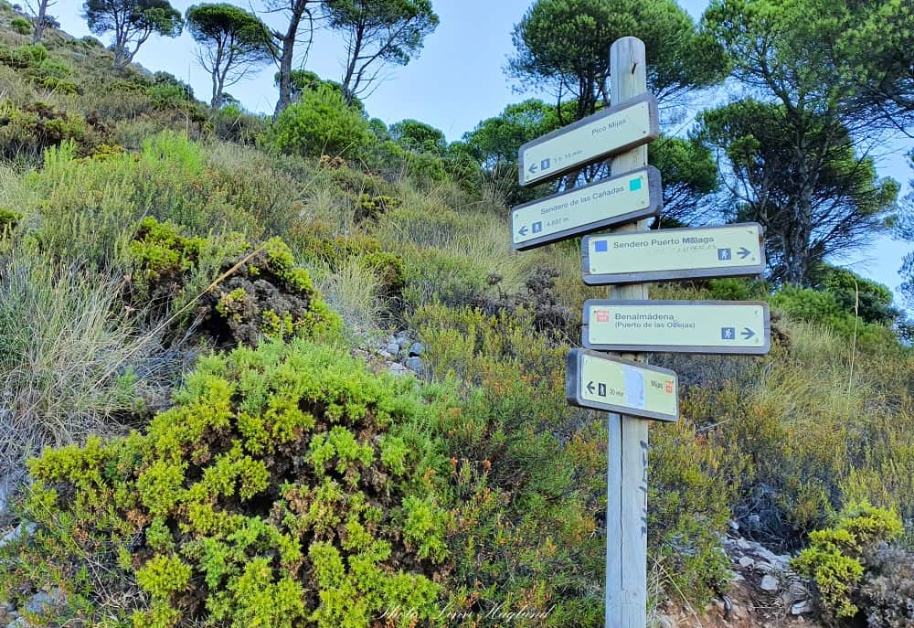
Sierra de Mijas hiking trails
All these trails can be explored with dogs, but be aware that the pine processionary caterpillars come out between late December/early January and early summer.
These creatures are deadly to dogs, so you can’t bring them hiking at this time of year. You can read more about these small predators here.
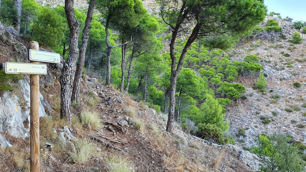
Cañada de Gertrudis Trail (yellow)
- Hiking time: 1,5 hours
- Length: 3,6 km
- Difficulty: Easy-Medium
- Type: Loop (descending by the blue trail)
- Elevation: ~300 meters
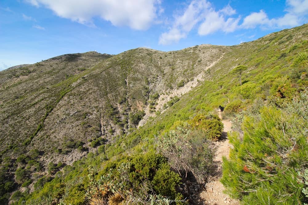
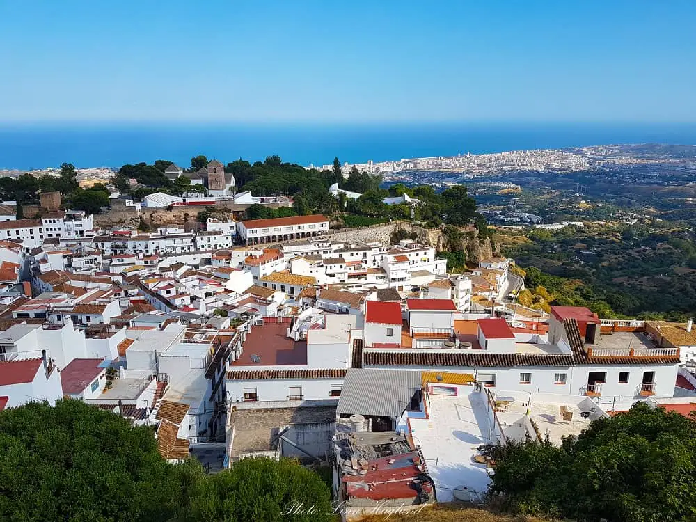
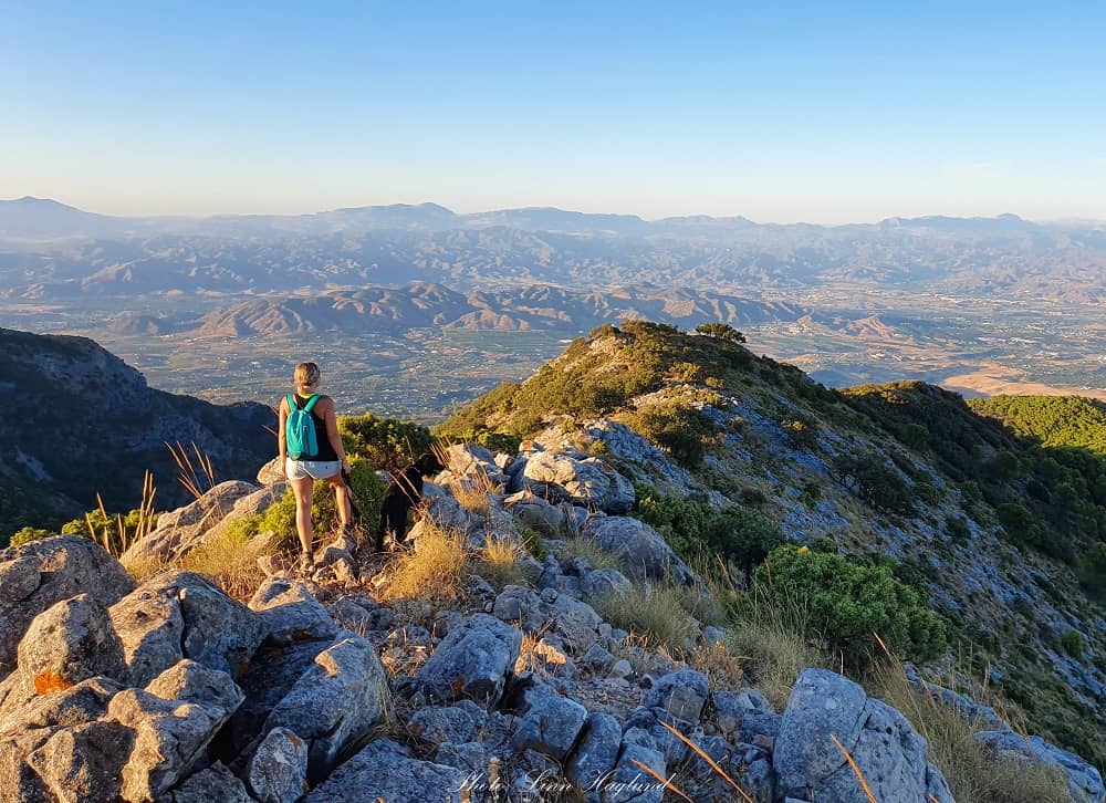
Cañada de Gertrudis Trail is a stunning short hike going straight from the trailhead and past the left turn where the other trails continue a couple of hundred meters from the start. It winds along the hillside through the fresh scent of pine trees covering up the trail, goes down to an opening where you can see and hear the road nearby before the ascent starts to take you back into the forest.
Once the trees give way and the trail gets steeper, don’t forget to look behind you. The views of Mijas Pueblo and the countryside below leading the way to the Mediterranean coastline are truly breathtaking.
After the steepest part, the trail goes horizontally along the vertical cliff side looking down at the village below. Continue until you see the signs to the blue trail heading towards Pico de Malaga to your right. You will take the left turn downwards.
Continue for a bit longer until the forest opens up and you get the views of the village in front of you. Turn left at the next two path crossings.
When you get down to the third crossing, you can turn to the right to see the Eremita del Calvario before you return, or take the left directly to continue down to the last right turn, 200 meters from the trailhead.
Another short hike you might like: Ruta de Los Venados in Sierra Morena, Cordoba
Pico Puerto Malaga Trail (yellow+blue)
- Hiking time: 3.5 hours
- Length: 7 km
- Difficulty: Medium
- Type: Linear or semi-linear
- Elevation: 640 m
- Altitude: 1045 masl
The hike to Pico Puerto Malaga is a good half-day hike returning the same way you got up, which makes it easy to follow.
Start by hiking up Cañada de Gertrudis Trail (yellow) and turn right where it meets the blue trail and continue up from there. Alternatively, you can cut down the hike by 30 minutes and walk straight up the blue trail and back again.
The yellow trail is steep, and so is the blue trail. Once you get up to the dirt road, you have to take the trail that goes to the left, right where the road turns. It’s only a few meters from where you get onto the dirt road.
There, you continue for a bit longer until you get to a path crossing where you can turn left to Pico Mijas or right to Pico Puerto Malaga, which is the peak on your right side. You only have a few more minutes to go.
Once you’ve turned right towards the peak, the path will open up to views of the landscape behind and the trail turns left. In this turn, you need to take the right path that leads through a tiny forest before you get to the last ascent to the peak.
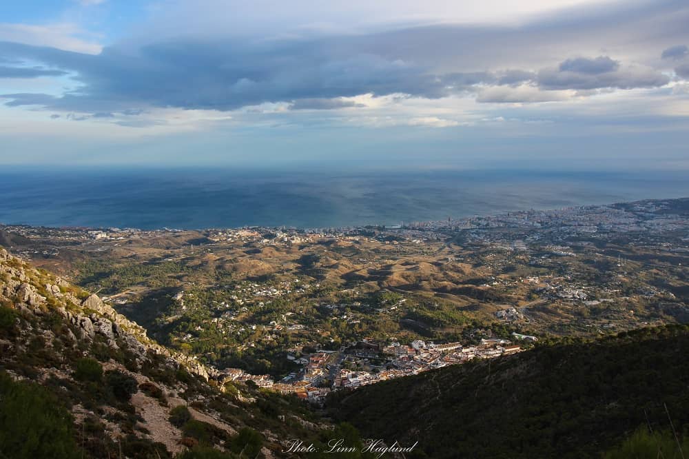
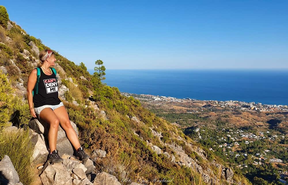
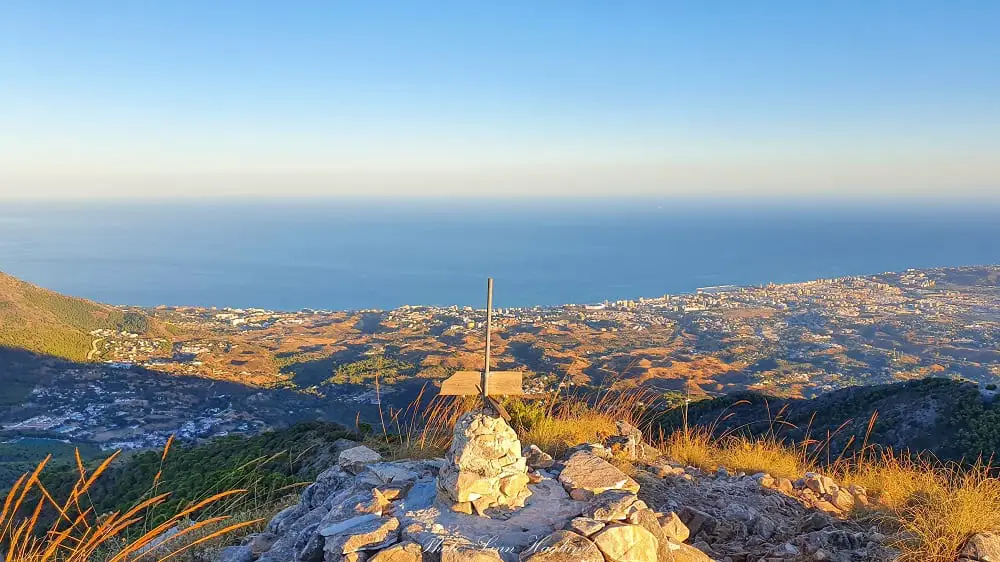
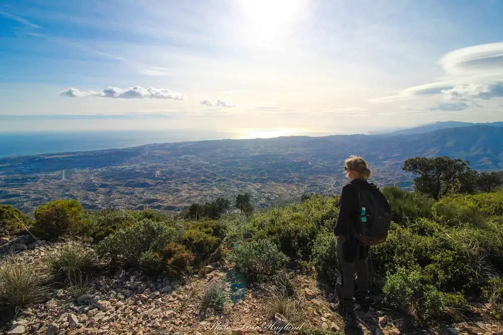
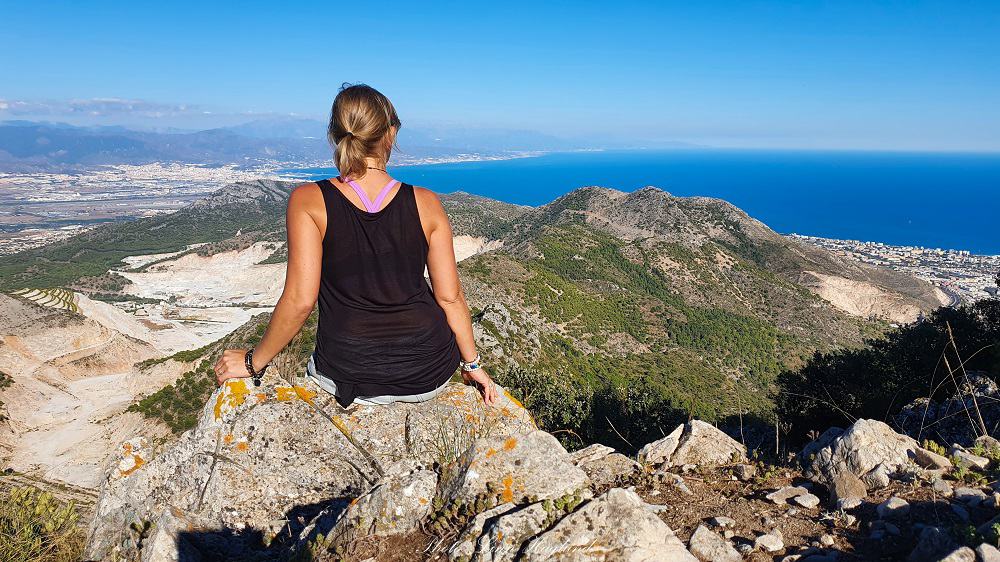
Pico Puerto de Malaga boasts some of the most spectacular 360 views on Sierra de Mijas. You see Pico de Mijas, Malaga, La Maroma peak, Pico Castillejo, Cerro del Moro (the antenna mountain), and Fuengirola’s coastline.
Walk the same way down, but instead of turning left (pretty much a u-turn) to the yellow route, keep walking straight down and follow the next couple of turns to the left before you arrive at the Ermita del Calvario. You can either check it out or turn left.
When you arrive at the trail crossing where it says yellow route to the left and red/white/blue where you’re coming from, turn right and continue the last couple of hundred meters down to the trailhead.
YOU MIGHT ALSO LIKE: Ruta de Los Cahorros
Cantera del Barrio Trail
- Hiking time: 1 hour
- Length: 3,6 km
- Difficulty: Easy
- Type: Loop
- Elevation: 279
Cantera del Barrio Trail is the easiest and shortest route you can hike in Sierra de Mijas. The one-way loop trail follows the blue route until you get to the crossing where the blue and the yellow route continues straight up and the red and white continues along the hillside.
Until this point, the trail is steep with loose rock and sand, but then it evens out and slowly starts to go back down again. Once it zig-zags down the hill, you get the most amazing views of the seaside.
When you get down to an open space and a wide dirt road with an abandoned building project, turn left to get back down where Ermita del Calvario is, just above Mijas Pueblo.
From here, you continue straight until you reach the first turn you took after the trailhead and you turn right back down the last couple of hundred meters.
This is a beautiful sunset hike with big chances of seeing Ibex.
Pico de Mijas
- Hiking time: 5-7 hours
- Length: 14,5 km
- Difficulty: Medium-Demanding
- Type: Linear or loop
- Elevation: 745 meters
- Altitude: 1150 masl
Pico de Mijas is the most popular yet longest trail starting from Mijas Pueblo. With 360 views of the coast from Malaga to Mijas and all the way to Morocco on a clear day, it’s hard to compete with.
Following the blue trail all the way until you get to the dirt road, enjoy the views for a bit before you continue.
You need to cross the dirt road and find a small trail where the road turns to the left just a few meters from you cross it. Here you’ll walk through the forest for a bit before it opens up.
After a few hundred meters, you get to a point where the trail divides in two, and Pico Puerto Malaga is to the right. Turn left here towards Pico de Mijas.
The path now goes towards the views of the Mediterranean again and goes along that side for a while before turning right and you’ll see the white “bola” at the far top in front of you. From here you see the rest of the path winding up the mountain in front of you.
Once you get to the top, you still have a few hundred meters left, and a short steep bank to climb before you get to the paved road that takes you the last few meters up to the top.
Walk around “La Bola”, the white round meteorological ball at the top for mesmerizing views of the mountain range on the other side.
You can make it a loop hike by start walking the red trail instead of the blue, all the way to the left, past the turn to the green trail, and all the way up to the peak. This feels easier at the beginning as the red trail is mostly flat, but you still need to get up to the same height to reach the peak, so once it starts to climb, it’s not any easier and I recommend the first described route.
Pico Castillejo
- Hiking time: 3,5 hours
- Length: 8,5 km
- Difficulty: Medium
- Type: Loop
- Elevation: 566 m
- Altitude: 973 masl
Boasting some of the best views in Sierra de Mijas, competing with Pico Puerto Malaga, Pico Castillejo makes an amazing excursion. The starting point is a bit further east of the village than the above trails and you can easily park there.
If you drive, take the turn to El Higueron from the A7 and continue up about 4-5 minutes until you see a small parking to your right in the middle of a sharp left turn. There is a big sign saying you can’t throw rubbish there (in Spanish), you can leave your car there.
Take the big path to your right and follow it for about a hundred meters until you can turn left. From there you continue all the way up until you are close to the antennas at the top of the mountains, you have to turn right or left. You turn left.
Follow this path until you get to the paved road next to the antennas. Follow the road a few meters down (left) and take off right to the large path signposted to Mijas. Not far from there, the path divides in two. Turn right here to walk the last 5-10 minutes to the peak.
When you walk back down again, you want to turn right where the path split and continue on this trail until you get nearly back to the main road where you parked the car. With the main road in front of you and the path turning right, you’ll see a small, narrow path turning to the left along the road. This path will get you the last minutes to where the car is parked.
If you walked from Mijas Pueblo, continue on the path where it turns right and walk the rest of the way on the road back where you came from when starting the hike.
Final thoughts on hiking in Sierra de Mijas
Hiking in Sierra de Mijas is without a doubt an amazing experience. There are different trails for different levels. Short and long hikes. The views are spectacular no matter if you are on one or the other side of the mountain range.
The best thing is that there are large chances of seeing Ibex (mountain goats) on your hike, especially if you go in the evening or return before sunset.
Make sure you respect nature and wildlife by not throwing any rubbish and not feed or chase the wildlife.
I highly recommend you get on your hiking boots and discover Sierra de Mijas, the mesmerizing mountains of Costa del Sol.
If there’s any information you miss about hiking in Sierra de Mijas, please shoot me a message in the comments and I’ll do my best to update the post with relevant information.
READ NEXT: Top bucket list hikes in Andalucia
Other hikes in Malaga:
Is there a dedicated coastal trail running between Malaga and Fuengirola.
Hey Rod, Good question! I have no idea as I mainly hike, but I also run in Sierra de Mijas on weekdays and there are hardly any people. I do see trail runners in most of the area but have never heard of any dedicated areas to it.
Was up on Cerro Malaga two days ago.Trying to find a route direct from Cerro Malaga (top of blue walk) to Pico Mijas. Is there a defined route or do we pick our own route? Takk skal du ha!
Hi Ed, the only route I have walked is back down the peak and where the hiking signs are, continue around to Pico de Mijas. There might be trails on the other side of the mountain though.
Hi – Your guide looks great. Are there any maps we could purchase for this trip.
There migth be maps in Mijas tourist office, but I’m not sure. At the trailhead of the hikes above the village you can see a general map where the trails are marked with colors. However, the trails are well marked with colors on the trail so you should be able to follow them easily. Happy hiking!