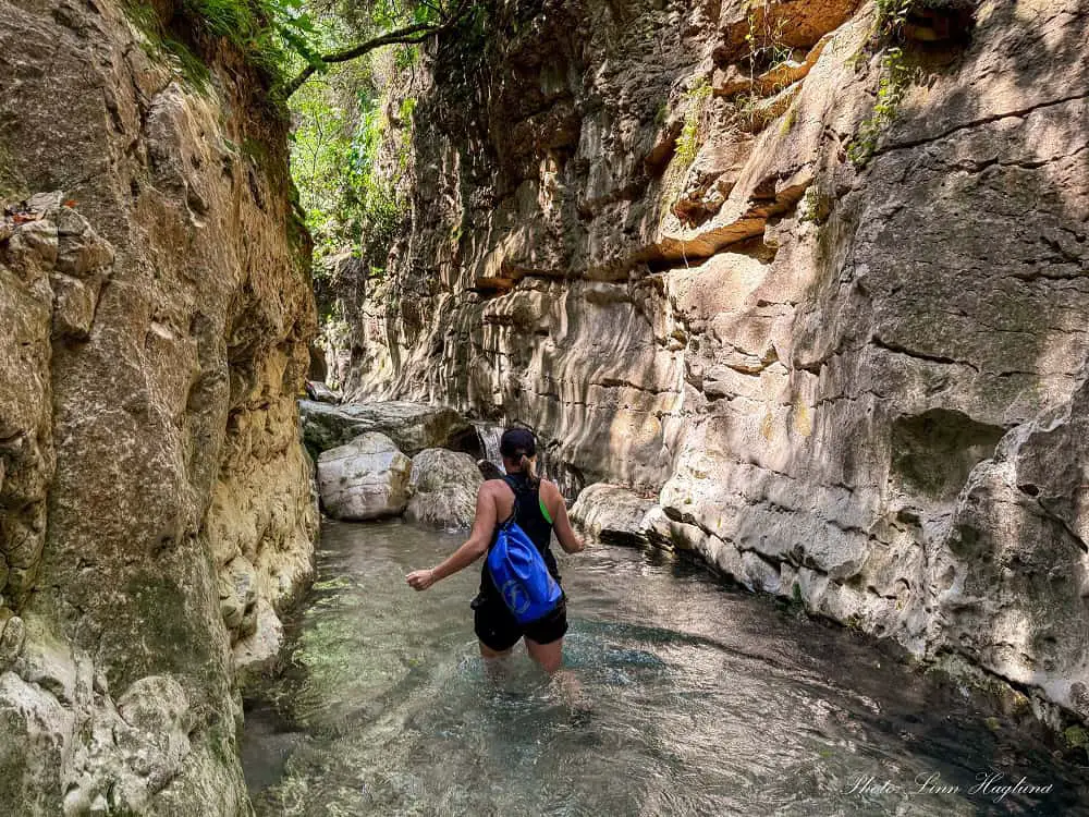
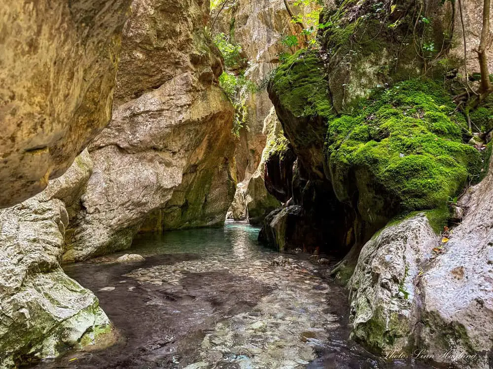
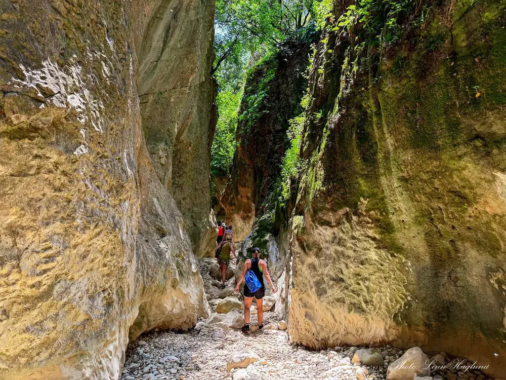
Hiking Arroyo Bocaleones is just magical! A refreshing river fills the narrow ravine, and small rapids cascade through rocks.
This is an aquatic hike and you need to swim at more than one place, making it a perfect summer hike.
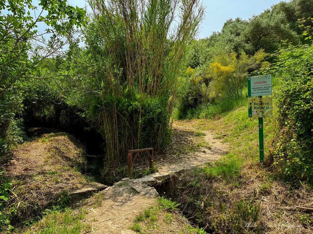
Arroyo Bocaleones is located amidst the lush Sierra de Grazalema Natural Park in Cadiz and is strictly protected due to a large population of griffon vultures who call it home. For this reason, you’ll need a permit, and dogs aren’t allowed in the ravine.
This guide will take you through everything you need to know before you go, including how to get a permit for the hike.
Disclosure: This post may contain affiliate links. That means that if you make a purchase through one of those links, I will get a small commission at no extra cost to you. As an Amazon Associate, I earn from qualifying purchases.
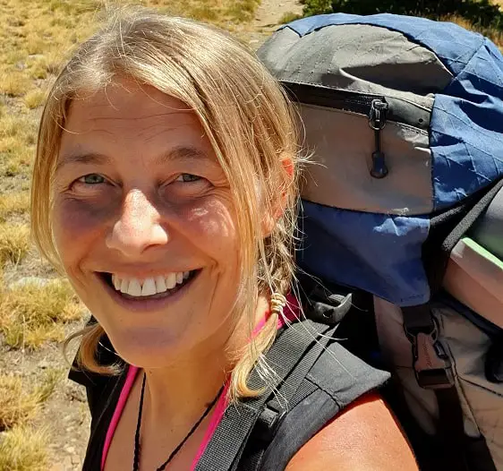
I’m Linn Haglund, the face behind Andalucia Hiking. I’m an avid hiker and after calling Andalucia home for over 10 years, I’ve covered my share of peaks, ravines, rivers, and valleys across all 8 provinces. I’m here to help you navigate this incredible region with thorough hiking guides, hiking tips, and gear recommendations.
PIN IT FOR LATER!
🌿BE A GREEN HIKER🌿
7 Leave No Trace Principles
Table of Contents
Practical information
- Province: Cadiz
- Length: 6 km
- Time: 2-2,5 hours
- Route: Linear return
- Difficulty: Moderate, but some sections of the river can be challenging
- Hiking season: May-October (whenever it’s warm enough to swim in the river
- Hiking with dogs: DOGS ARE NOT ALLOWED IN THE RAVINE (only on the path up to the ravine)
Getting a permit for hiking Arroyo Bocaleones
For most hikes that require a permit in Andalucia, you can easily obtain one online. But not for hiking Arroyo Bocaleones.
To get a permit for hiking Arroyo Bocaleones, you must email the following address: pnSierraGrazalema.UsoPublico.csmaea@juntadeandalucia.es
You will need to inform them of how many permits you need, ask what dates there is availability, and wait for their response.
When you receive the available dates, pick the one that works best for you and reply to them with the desired date.
If no one else picked the last permits for your desired date, they’ll confirm it for you.
Note that they allow a maximum of 50 people into the gorge per day, and one person can only apply for 8 permits.
If you plan to go in a larger group, more than one person has to apply for a permit until you reach the desired number.
While I recommend going in smaller groups to restricted areas like these to reduce noise levels, this is actually one of the few hikes I don’t recommend going alone.
The simple reason why you should at least be two people is that some sections have strong streams cascading into deep water pools where it’s hard to get past without anyone supporting.
I’m sure it’s not impossible, but it’s certainly a lot easier and safer.
Note that it’s not allowed to enter the ravine after 16:00.
How to get to the trailhead
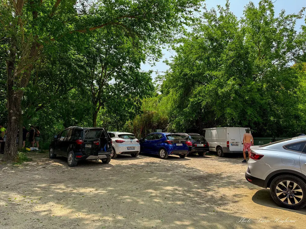
The trailhead is located just a 10-minute drive from the picturesque village of Zahara de la Sierra. You can walk the stretch in about 40 minutes, but as far as I could see, it would be mostly along the road.
There is a small dirt parking area along the road at the trailhead with space for around 10 cars. There you’ll see the start of the trail easily.
I recommend downloading the app Wikiloc so that you can follow the trail, but mostly because it will guide you to the trailhead (just click on “driving instructions to trailhead”).
Here is the trail I recorded. Never mind that I forgot to turn it off after I returned to the van, the route is intact.
CHECK THE ROUTE ON WIKILOC
When is the best time to hike Arroyo de Bocaleones
From what I understand, you can apply for a permit to hike Arroyo Bocaleones all year round. However, the water in the river is super cold, and the ravine offers shelter from the elements, keeping the temperatures cool.
Therefore, I recommend going in the summer season when the weather is hot. We went in May, and even though the day was scorching hot, it was a bit too cold for me to immerse myself completely in the river. And there is no way around it. But I survived to write this guide, and I would do it again.
If you live in Andalucia, you know that the summer weather can last until early November some years and late September-early October other years, so it’s hard to set a “date” on the best season to do this hike.
What to bring
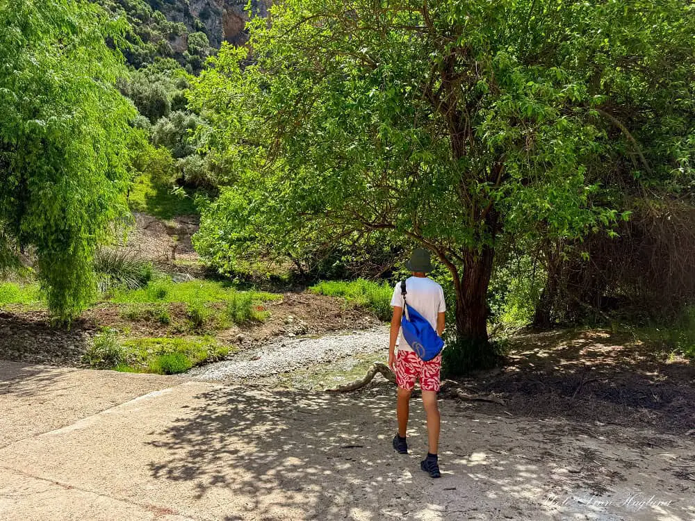
This is a semi-aquatic hike, which means you’ll do the first two kilometers on land before walking in the river and even swimming.
Two of the most important things to remember are that you’ll walk in water and you’ll swim.
You’ll need good water hiking shoes with grip on wet ground. You can check out my top picks here.
You’ll also need a waterproof backpack or dry bag to keep your belongings safe. Here are my top picks. I also recommend having a separate waterproof bag for your phone to easily take it up and down to take pictures while keeping it dry.
The first 2 kilometers offer some shade, but I recommend a cap or a hat on a sunny day to protect your head (you gotta walk back the same way).
If you have sensitive skin to the sun, a reefproof, natural sunscreen is good, so it does the least harm to life in the river.
Finally, choose clothes that dry quickly, good hiking shorts and tops usually do. Just make sure your pockets are empty when you start the water section!
THINGS TO BRING
- water hiking shoes
- fruit or other snack
- water
- waterproof backpack or bag
- caps
- reef safe sunscreen
OTHER EIPC RIVER HIKES IN ANDALUCIA
- Rio Verde, Otívar (Granada)
- Ruta de los Bolos, Dúrcal (Granada)
- Barranco de la Luna, Saleres (Granada)
- Cahorros de Monachil (Granada)
- Rio Verde, Istán (Malaga)
- Rio Borosa (Jaen)
- Rio Cerezuelo (Jaen)
Where to stay
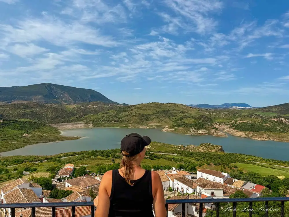
I recommend staying in Zahara de la Sierra when doing this hike. It’s one of the most picturesque white villages in Andalucia with incredible views of the Zahara-El Gastor Reservoir.
Besides, there are so many other amazing hiking opportunities nearby, like Garganta Verde (that also requires a permit).
There are several private holiday rentals around the village, but these two hotels are also fantastic and budget-friendly:
LA JARANA Casa Hotel – centrally located in the village with neat and clean rooms. I loved how they made me feel at home!
Hotel Tugasa Arco de la Villa – lovely, cave-like hotel with unmatched lake views. Had an amazing stay!
Hiking Arroyo Bocaleones
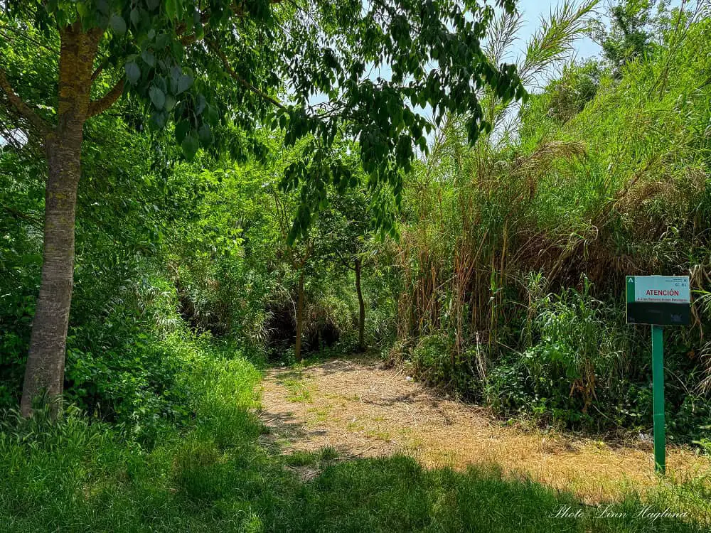
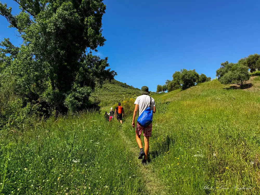
As mentioned above, the hike starts at the parking area, and the first two kilometers are on dry land. It begins along the river and takes you up along fields where the path can be fairly overgrown, especially in spring.
But it’s not hard to follow.
After about a kilometer, there’s a small waterfall and swimming hole to the left og the trail where you can cool down if you need it before you continue.
The path is a little hidden due to the massive vegetation. If you follow my Wikiloc recording, I walked in there, though I forgot to add a waypoint, so it probably won’t notify you before you have passed it.
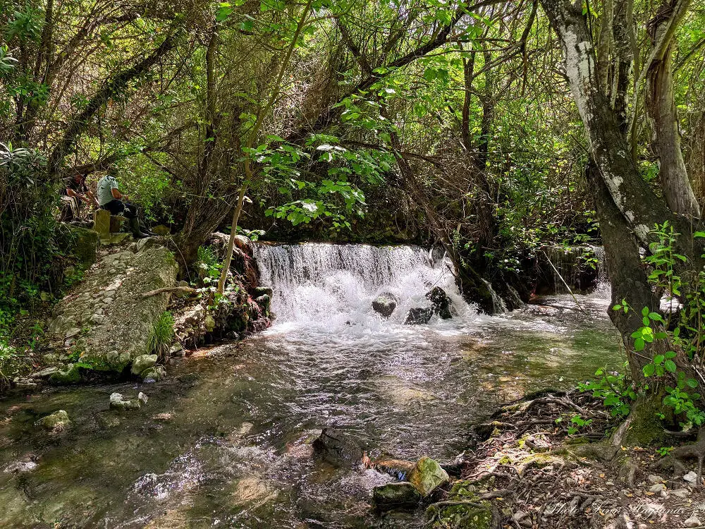
I recommend that you keep an eye out on the recorded map (you’ll see a small detour to the left, and it’s marked with a waterfall on the map).
Once you continue on the trail, it’s not far until you reach a wide dirt road where you continue to the left, and shortly after, the road crosses the river.
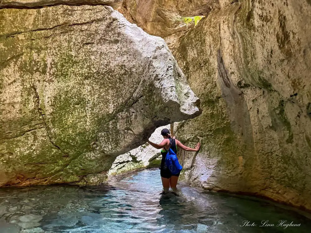
We started walking in the river to the right, right there, but you can continue on dry land a little further by crossing the river and turning right just after. There’s a path that goes parallel to the river before you get into the water by another “one-eyed” stone bridge that lets the river flow through.
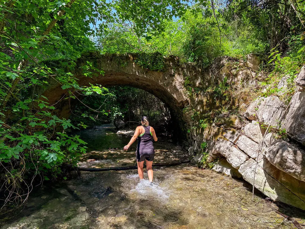
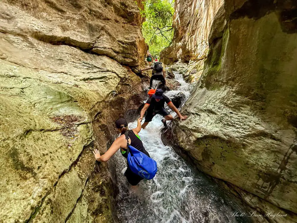
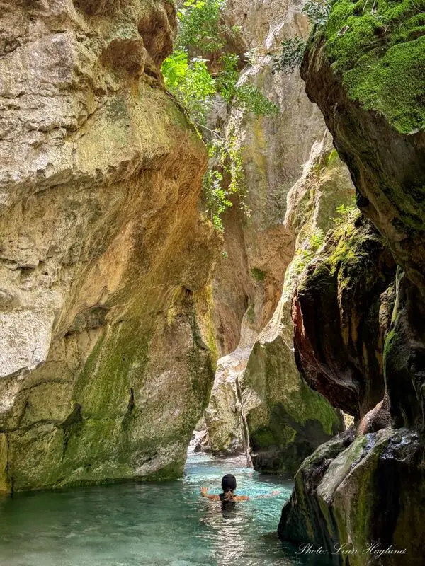
Not long after you walk under this bridge, the water levels rise. There are stretches where you can walk with water to your hips, and other sections where the water gets so deep that you must swim to continue.
As I mentioned above, I don’t recommend doing this hike solo. There are some sections with heavy streams and small cascades leading into deep water holes with strong currents.
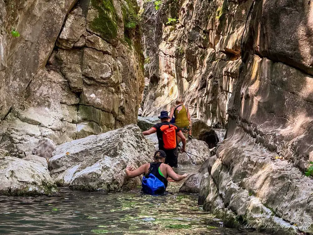
I found some of these places complicated to find a safe grip for my feet and a place to hold on to. I don’t know how I would have solved it without help, though I probably would have.
However, these sections are also higher risk for injury if you slip, especially due to the current.
I’m sure it’s easier if your legs are a little longer than mine, but I wanted to share my experience, so you are prepared.
It’s possible to walk deeper into the canyon than we did, but it will get more complicated, and most people who venture further ahead are all canyoneers.
I suggest you walk as far as you’re comfortable with before you turn around again.
OTHER HIKES IN SIERRA DE GRAZALEMA NATURAL PARK
Reflections on Arroyo Bocaleones hike
Summing up, the Arroyo Bocaleones hike in Cadiz’s Sierra de Grazalema Natural Park is a fantastic semi-aquatic hike that I highly recommend.
It’s best to do it in the hottest months when it’s refreshing to cool down in the water, but make sure you’re prepared with the right gear.
Happy hiking!