Hiking La Tiñosa, Cordoba’s highest peak is a true bucket list hike in Andalucia. You’ll need a permit to do the hike, but that just makes it even better because you dodge the crowds of other impressive hikes in the region.
The roof of the UNESCO-listed Sierras Subbéticas Natural Park seems easy to climb at first but trust me, the last few hundred meters aren’t exactly a walk in the park.
That said, every drop of sweat will be justified the moment you reach the top and see what a beautiful 360-view you’re treated with!
In this post, I’ll go through everything you need to know to hike La Tiñosa Peak from Las Lagunillas village in Cordoba province, including how to obtain a permit.
Disclosure: This post may contain affiliate links. That means that if you make a purchase through one of those links, I will get a small commission at no extra cost to you.
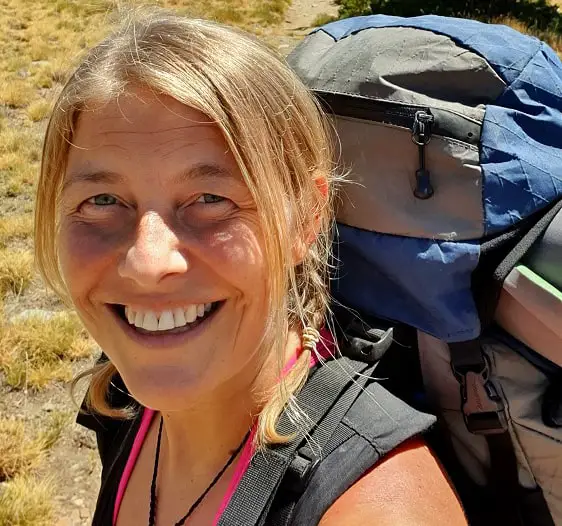
I’m Linn Haglund, the face behind Andalucia Hiking. I’m an avid hiker and after calling Andalucia home for over 10 years, I’ve covered my share of peaks, ravines, rivers, and valleys across all 8 provinces. I’m here to help you navigate this incredible region with thorough hiking guides, hiking tips, and gear recommendations.
Read the 7 Leave No Trace Principles before you go
Table of Contents
Practical information
- Province: Cordoba
- Mountain range: Sierras Subbeticas
- Length: 11.4 km
- Time: 5-6 hours
- Elevation: 750 meters
- Altitude: 1570 masl
- Route: Linear return
- Difficulty: moderate to challenging
- Hiking season: mid-September to May
- Hiking with dogs: Hiking with dogs is permitted and there are no pine trees, thus no Pine Processionary Caterpillars so it is safe all year round.
- Permit: Permit needed
How to get to Las Lagunillas and the trailhead
Las Lagunillas is located in the foothills of La Tiñosa about 118 kilometers from Cordoba city. I’ve tried really hard to figure out the possibility of getting there by public transport without any luck, so I’m pretty sure you’ll need a car to get there.
It takes about an hour and a half to drive from Corodoba to Lagunillas and an hour and 20 minutes from Malaga.
It’s easy to get there with the GPS, just make sure it’s Las Lagunillas in Cordoba Province you’re getting up and not somewhere else in Spain (Apparently, there are quite a few around.) You can also use this Wikiloc route to find it by choosing the option of driving route to the trailhead.
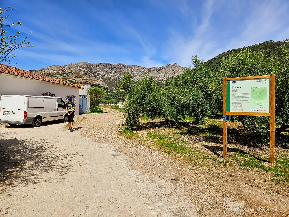
The trailhead is located right on the outskirts of Las Lagunillas village. You can plot in “La Tiñosa trailhead” in the GPS, but note that there isn’t any parking there.
The start of the trail is on private land, so you should park in the village and walk up. I suggest you use this Wikiloc route that I recorded to reach the trailhead and follow the route.
Make sure you show respect while walking through private farmland.
FOLLOW LA TIÑOSA TRAIL ON WIKILOC
When is the best time to hike La Tiñosa
La Tiñosa is a great hike almost all year round, but in the summer months from June to mid-September, it’s way too hot!
Therefore, I recommend mid-September to May (or even mid-June if it’s not too hot) for this hike.
I truly love the spring there, as the flowers come out and color the fields, but even in winter, though it’s colder, is fabulous!
What to bring
What hiking gear you need when hiking La Tiñosa in Cordoba depends on what time of the year you go. In the warmer months, shorts and a t-shirt might be enough, but even then, it can get windy at the top and possibly cooler temperatures making it essential with a windbreaker.
Good hiking shoes or boots are important too. It might seem like an easy hike at first, but once you reach Puerta Mahina mountain pass, you have a heavy ascend on rocky terrain ahead of you the last few hundred meters to the top.
For the same reason, I’d recommend bringing hiking poles, it will make it a lot easier to ascend the summit. also, if you have knee issues like I do occasionally, it can be a good idea to have a pair of hiking knee braces in the backpack in case you need it on the way back down.
In the colder months, I recommend bringing a buff, mittens, and a beanie even if you don’t wear it all the time, and an extra layer of clothes like a fleece in your backpack – and don’t forget a windproof jacket.
The trail to La Tiñosa doesn’t have many water sources, so I recommend bringing a 3-liter water bladder to make sure you don’t run out of water. If you bring your dogs on the hike, make sure you’ve got extra for them too.
THINGS TO BRING:
- lunch
- fruit or other snack
- water bladder
- windbreaker
- hiking poles
- buff
- extra layers depending on the weather forecast
Note that Las Lagunillas is a very small village and the bakery and grocery stores are not even possible to find without asking as they look like they’re just set inside private homes.
So I recommend purchasing the necessary supplies before reaching the village – we bought bread at the bakery and some fruit in the supermarket, but it was very limited what we could get hold of.
Where to stay
As mentioned before, Las Lagunillas is a very small village and I haven’t really found much accommodation there (but feel free to ask around, I’m sure they’d appreciate the tourist income!)
If you don’t find anything there, I recommend staying in Priego de Cordoba. It’s a fantastic town only around 8 kilometers away with plenty to do and see.
Where to stay in Priego de Cordoba:
Casa Baños de la Villa – A fabulous boutique hotel in the heart of the town’s oldest and cutest quarter Barrio de la Villa. Make sure you try the Arab baths!
Hotel Patria Chica – Centrally located a short walk from Fuente del Rey, this stylish hotel with wooden beam sealings and a cute patio is set amidst a lively area with plenty of restaurants and bars.

How to obtain a permit to hike La Tiñosa
To hike La Tiñosa you need a permit, as it is a strict nature reserve. Luckily, it’s easy to obtain online.
Click this link to apply for a permit
Once you click the link, you can choose what kind of ID you want to use. If you don’t have a Spanish ID card like DNI or NIE, choose “Otros del titular” in the drop-down and write your passport number in the section below.
Press “Siguiente” to get to the next page.
There, you start with the drop-down “Espacio”. Choose “Parque Natural Sierras Subbéticas”.
Next, choose the following under the drop-down next to “Actividad”: “Sendero de La Tiñosa – Sendero Señalizado”.
In the field, “Itinerario” choose “Sendero de La Tiñosa” it will also show the dates of the current year.
Choose a date in the calendar. If there are no green dates available, it means that there are no available dates to choose from. Usually, you can get back to it later to see if new dates are released.
When you have chosen an available date, the chosen date will appear next to “Fecha Seleccionada” and you choose “Horario”. Eg. Todo el Dia.
Type in the number of hikers including yourself in the field “Nº Visitantes” and then “Next”.
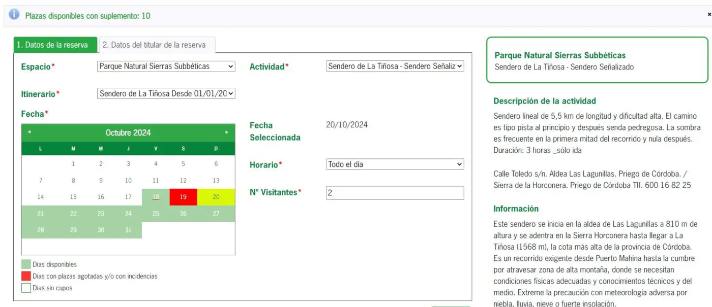
Under the tab “Datos del Titular de la reserva” you need to fill out your contact info before clicking Siguiente.
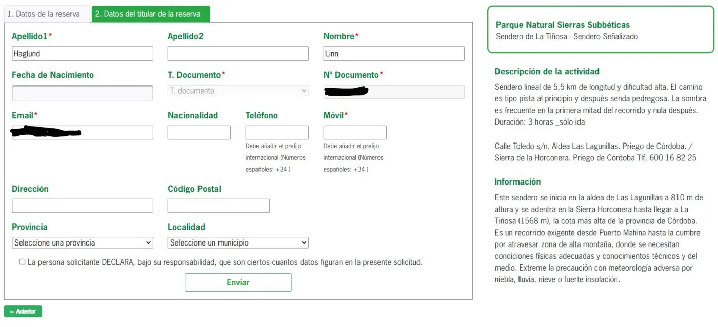
You will receive an email with a link to confirm your reservation. Without doing so, the permit isn’t valid.
Once you have received the actual permit, I suggest you take a screenshot of it so that you have it available offline on your phone in case you need to show it on the trail.
CHECK OUT OUR VIDEO FROM OUR FIRST HIKE TO LA TIÑOSA
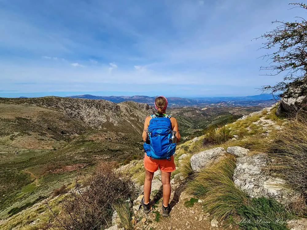
Hiking La Tiñosa, Cordoba
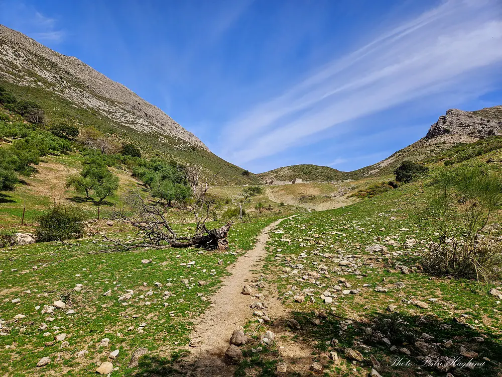
When you reach the trailhead by the farmhouse as indicated on the map and Wikiloc trail linked in the “how to get there” section, you need to walk straight on the path taking you across the farmland. At the end, you’ll find a small, wooden gate to exit the private property.
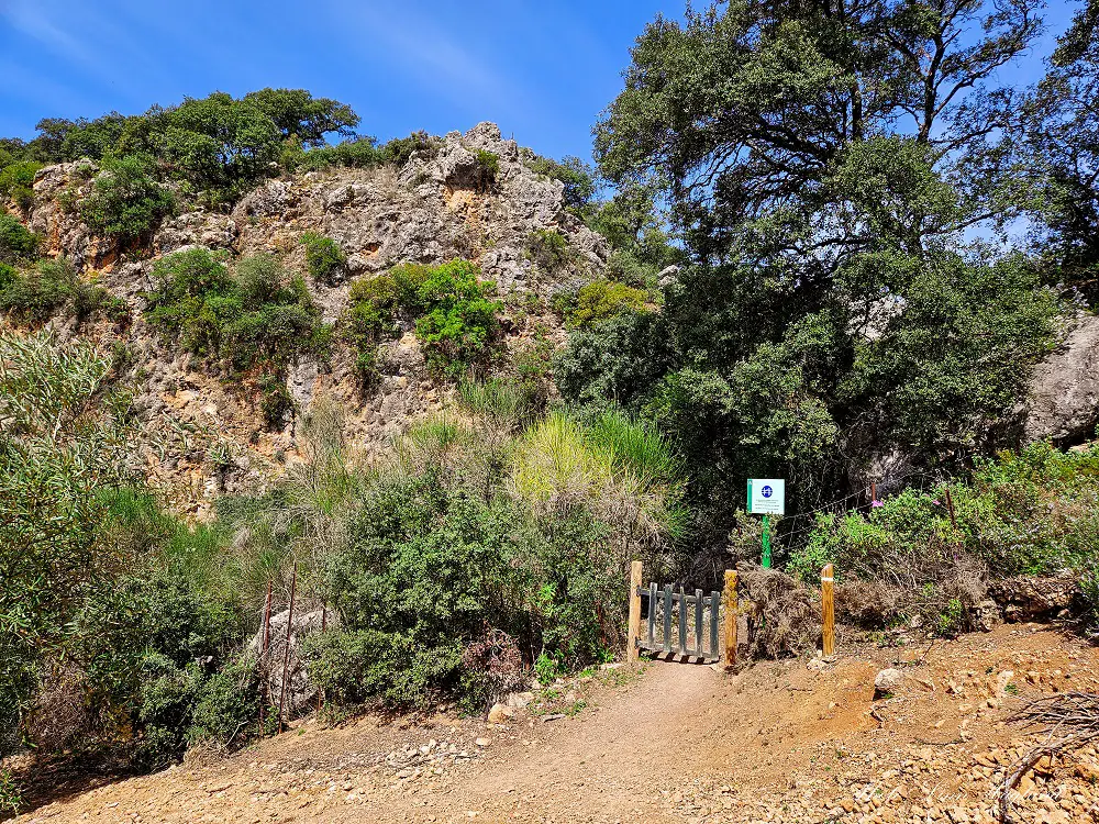
From there, it’s easy to follow the trail along the riverbed and on its side. At one point, it opens up and there’s a sign to La Tiñosa to the right.
We saw a lot of sheep and cows in this area both up and down, so make sure you have control over any dogs you’ve got with you.
The trail was actually quite well-marked when we were there. After a while, you’ll walk on an open hill where you come across the ruins of an old house.

Just above it, there are a couple of trees that provide shade before the path continues up toward the Puerto de Mahina pass which is at 2200 meters of altitude.
There, you’ll walk through another gate and take the trail to the right. It’s well marked there too, but don’t get fooled by the fact that it’s only 2 kilometers left!

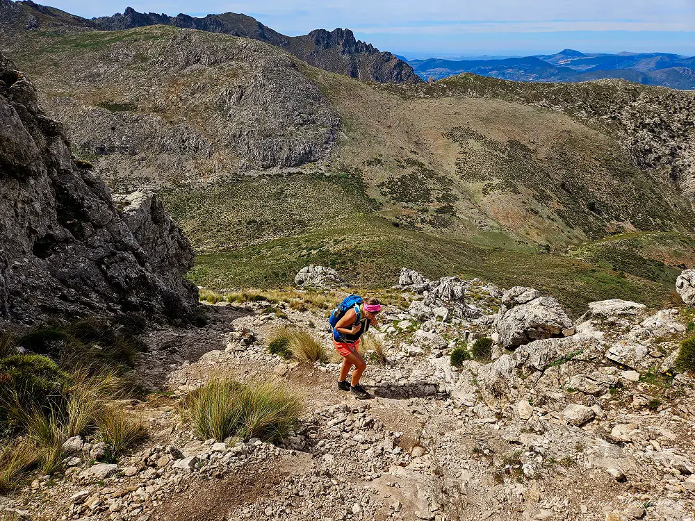
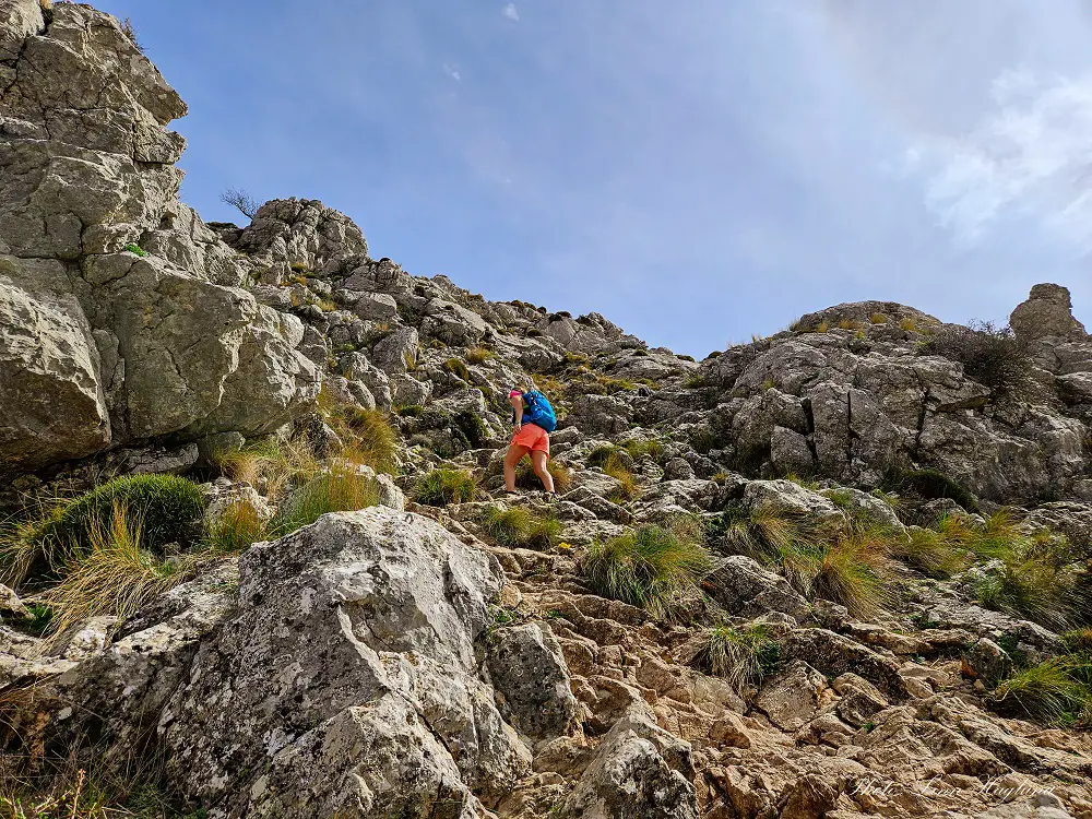
Just before you reach the mountain towering in front of you, there are large warning signs that you’re entering a high-altitude hiking area, and a high physical condition and mountain knowledge is required to continue.

As we started the climb, we kinda understood what they meant with the sign, though it’s the first time I see such a sign in Andalucia and I’ve been to a lot more extreme hiking environments than that in the region.
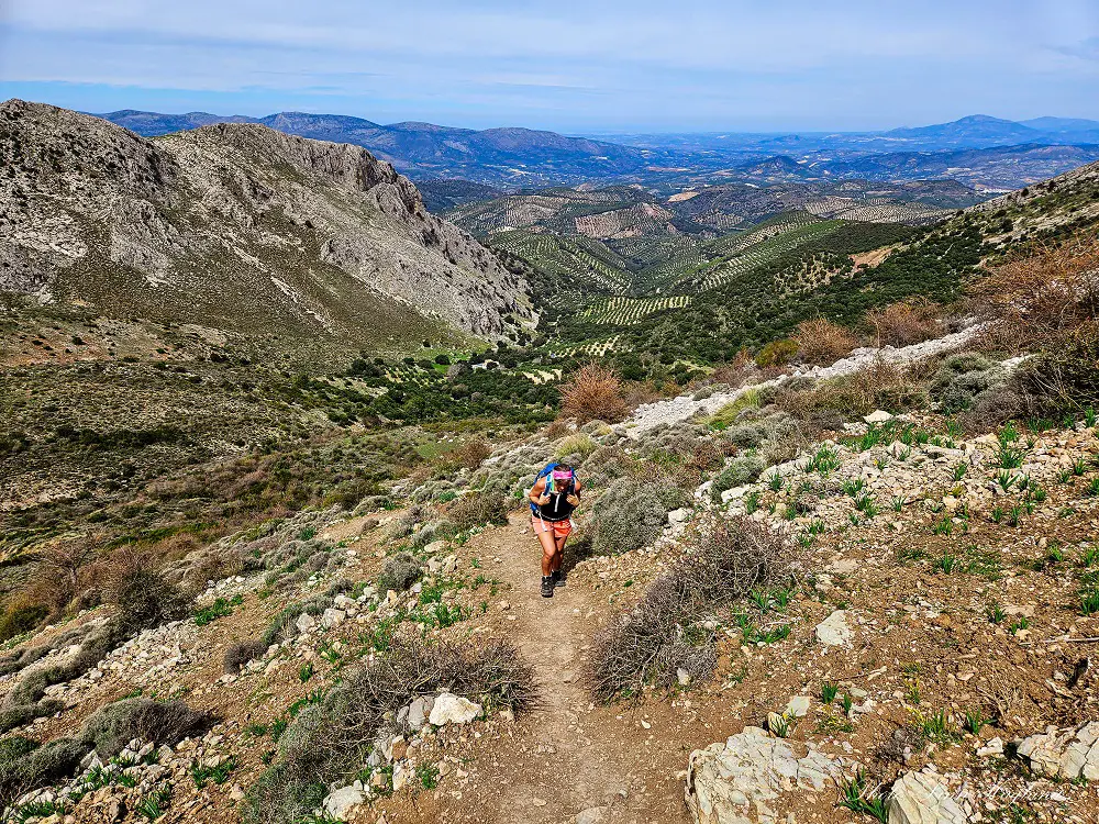
The ascent is steep, but the trail is easy to follow. After reaching the steep ascent, it flattens out a little before reaching a section with chains taking you across a plain mountain section that goes pretty steeply down to your right.
After this, the rest of the trail is fairly easy, a mesmerizing view of the high Sierra Nevada opens up in front of you before you eventually reach the peak.

In this last section, we observed a lot of sheep, so be aware if you have dogs with you.
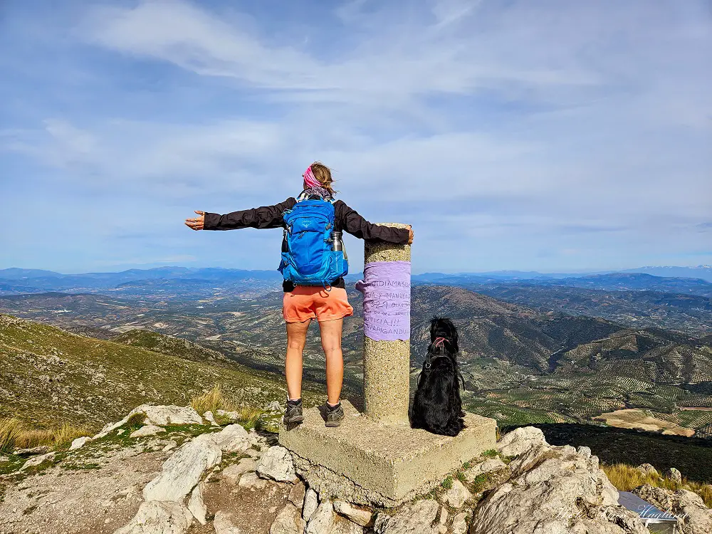
On the top of La Tiñosa, the 360 views are spectacular! You can see several towns like Priego de Cordoba and the Sierra Nevada’s 3000-meter peaks.
The return is the same way you came from.

OTHER HIKES IN CORDOBA PROVINCE
👉Rio Bailón from Zuheros
👉Ruta Pinos, Vegosa, Venados y Plata
👉Ruta de Los Venados
Reflections on La Tiñosa hike
Summing up, hiking La Tiñosa, Cordoba is a fantastic experience. Nature is fabulous all the way and with different difficulty levels from start to finish, it brings on enough variety and challenges to make it a memorable experience.
I love that you can see the Sierra Nevada from the trail and still, nature in the Sierras Subbeticas is a completely different affair.
I highly recommend this hike to anyone who’s looking for an epic peak off the beaten path in Andalucia.
Happy hiking!